Whiteface Elevation: 4,020 ft
Passaconaway Elevation: 4,043 ft
Total Distance: about 12 miles
Estimated Time: 8 hours
Difficulty: Moderate
Views: Very Good, but not from the summits

Mount Whiteface
Around the backside of Wonalancet, you will come to an intersection. The Dicey's Mill Trail continues on straight, but you want to take a left onto the Tom Wiggin Trail (1.1 miles).
 |
 |
Almost immediately you will cross over the Wonalancet River and the trail continues on the other side.

Very soon after this the trail will head virtually straight up the mountain. This part of the trail is extremely steep and difficult. I highly recommend hiking poles to help keep your balance and to pull you up. The trail is occasionally marked with blue dots painted on trees, however a number of times I had to simply choose the path of least resistance and only later found the blue dots to confirm I was still on the trail. Once you get past the conifer tree line the trail levels out a bit until it eventually merges with the Blueberry Ledge Trail coming in from your left.

Head right and go 0.6 miles up the Blueberry Ledge Trail which is basically a ridge trail up to the summit. You will soon come to the sheer rock ledges after which the trail is named. This is the most difficult part of the whole hike. For some of these you'll need to pack up your poles and use your hands for some straight up rock climbing.

On your way up the ledges, enjoy the impressive views which are the widest you'll get all day. You can see southwest all the way to Winnepasaukee and Squam Lakes and north to Mt. Washington. Make sure to get your photos of the northeast view on the way up because the view from the peak is south and west.

Continue up the Blueberry Ledge Trail until the McCrillis Trail comes in from the left. There are many large boulders here with open views to the south and west. This is a great spot for a snack break and where you'll find the peak marker. Unfortunately, facing west means that the later in the day you get here the more your photos will be backlit.
 |
 |

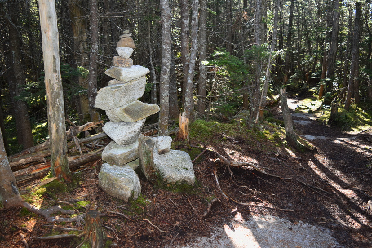
Although for purists, this is not yet the actual summit. Go left onto the Rollins Trail for another 0.2 miles (passing the Kate Sleeper Trail on your left along the way) where you'll find a conspicuous cairn on the side of the trail which marks the true highest point. But it's heavily wooded so there's no view.
 |
 |
Mount Passaconaway
Continue on the Rollins Trail for 2.2 miles. It starts as a ridge trail, then descends gradually with a few switchbacks as it winds down the south side of the ridge to connect with the Dicey's Mill Trail. At the T intersection, turn left to head up Dicey's Mill (0.9 miles).
 |
 |
After stepping over a small stream you'll come to an intersection with a sign for the East Loop to the Walden Trail. Even though the sign says Passaconoway Summit, don't go that way because it's the long way around. Stay to the left and continue up Dicey's Mill Trail.
 |
 |
At this point the trail turns steep and is the most difficult part of the Dicey's Mill Trail. At times it's as though you're hiking up a rocky water runoff. Near the top the trail opens up to a flat rock with views out to the northwest.

A few yards further up the trail you will come to a three-way intersection with a small summit trail heading off to the right and the Walden Trail coming in from the other side. Go right up the small trail for a few yards and find a small cairn at the official summit. Unfortunately this area is heavily wooded without a view.
 |
 |
But don't despair, you didn't come all this way in vain. Go back out to the 3-way intersection and turn right onto the Walden Trail. Just around the corner you'll see a small trail to the left with a sign that says "To View." This trail descends a few tenths of a mile, then opens up to a small flat rock with gorgeous views to the north across the Kancamagus Valley all the way to Mt. Washington.

Your descent follows back the way you came up. When you get back to the Rollins Trail intersection, continue straight down the Dicey's Mill Trail for 1.8 miles. This is an easy, gradual descent and anywhere it gets remotely steep they built little stone steps. Near the bottom you'll cross back over a Wonalancet River tributary.
 |
 |
You'll pass the intersection with the Tom Wiggins Trail on your right, and now you're again retracing your steps 1.6 miles down the Dicey's Mill Trail back to Ferncroft Rd and the trailhead parking.
Official Trail Map: (click to enlarge)

From one purist to another, there is only one word that comes to mind...majestic.
ReplyDelete